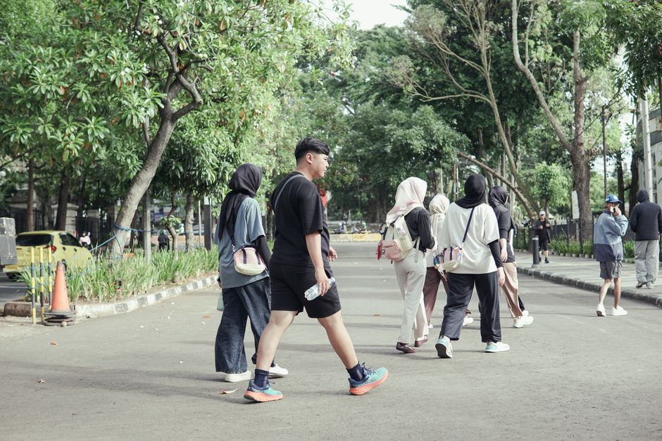
More than 60 percent of Milanese residents now walk at least 30 minutes daily for health reasons, according to a 2025 survey by the Comune di Milano's Urban Mobility and Quality of Life office — a figure that places the city above the EU average of 51 percent and well ahead of London and Paris. Walking, it turns out, is having its moment, and Milan's geography makes it unusually well-suited to capitalize.
The timing matters. Heat records across much of Europe this summer have pushed urban wellness planners to prioritize shaded, green-corridor routes over gym memberships and crowded fitness studios. In Milan, average July temperatures in 2026 have already touched 36°C on three separate days, making the choice of when and where to walk as important as the walk itself. The city's parks and canal paths — many tree-lined and naturally cooler by two to four degrees than surrounding streets — are filling up earlier each morning.
The 8 Routes: From a Gentle Stroll to a Half-Day Urban Trek
1. Sempione Park Loop (1.5km, Easy). The flat gravel path circling the interior of Parco Sempione is the city's most forgiving introduction to structured walking. Entrances off Via Gadio and Viale Elvezia keep the route accessible from multiple Metro 2 stops. Best before 8am on weekends.
2. Castello Sforzesco Perimeter (2km, Easy). The exterior circuit of the Castello Sforzesco takes roughly 25 minutes at a comfortable pace. Piazza Sempione at the northern end offers a natural rest point.
3. Naviglio Grande Towpath (4km one way, Easy-Moderate). Running from the Darsena basin in the Navigli neighbourhood northwest toward Corsico, this flat canal-side path is the closest Milan gets to dedicated walking infrastructure. The Associazione Naviglio Grande has maintained public access agreements since 2019.
4. Parco delle Basiliche Circuit (3km, Easy). Threading between the Basilica di Sant'Eustorgio and the Basilica di San Lorenzo Maggiore through the Porta Ticinese neighbourhood, this route doubles as a free open-air architectural tour.
5. Boscoincittà Forest Trail (5km loop, Moderate). Managed by Italia Nostra, Boscoincittà in the western district of San Siro offers proper woodland paths — rare inside a major European city. Uneven terrain and some brief elevation change qualify it as moderate.
6. Martesana Canal Path (7km, Moderate). The Alzaia Naviglio Martesana runs northeast from Piazza Gorini toward Cassina de' Pecchi. Paved and well-lit, it is increasingly popular with commuter walkers who exit at Vimodrone and return by suburban rail.
7. Parco Agricolo Sud Loop from Gratosoglio (9km, Moderate-Hard). For walkers comfortable with longer distances and some unpaved sections, the southern agricultural park accessible from the Gratosoglio neighbourhood offers genuine countryside within the city boundary.
8. Full Navigli Network Circuit (12km, Hard). Linking the Naviglio Grande and Naviglio Pavese via the Darsena and looping back through Porta Genova, this route demands solid footwear and a realistic three-hour commitment. Not recommended between 11am and 4pm in July.
Global Trend, Local Uptake
Walking as a structured wellness practice — not commuting, not shopping, but intentional daily movement — has accelerated globally since 2023. The World Health Organization's Global Action Plan on Physical Activity set a target of reducing physical inactivity by 15 percent by 2030. Milan's municipal government embedded that goal into its PGT 2030 urban planning framework, allocating €4.2 million to pedestrian corridor improvements between 2024 and 2027, including new signage on the Martesana path and lighting upgrades in Boscoincittà.
Membership in Milan's walking clubs tells a similar story. The Club Alpino Italiano's Milan section reported a 28 percent rise in urban walk enrollments between January and June 2026, compared to the same period in 2024. Saturday morning guided walks, which cost between €5 and €12 per person depending on route length, now book out within 48 hours of posting.
The practical advice is simple: start before 7:30am through July and August, carry at least 750ml of water on any route over 4km, and wear proper footwear — the Martesana path in particular has uneven cobbled sections near the Incoronata church. The Comune di Milano's MilanoInMovimento app, updated in March 2026, maps all eight routes with real-time shade and hydration stop data. Download it before you go. And if a nagging knee or hip has been making you hesitate, a conversation with your medico di base — your GP through the SSN public health system — is the right first call before ramping up distance.